
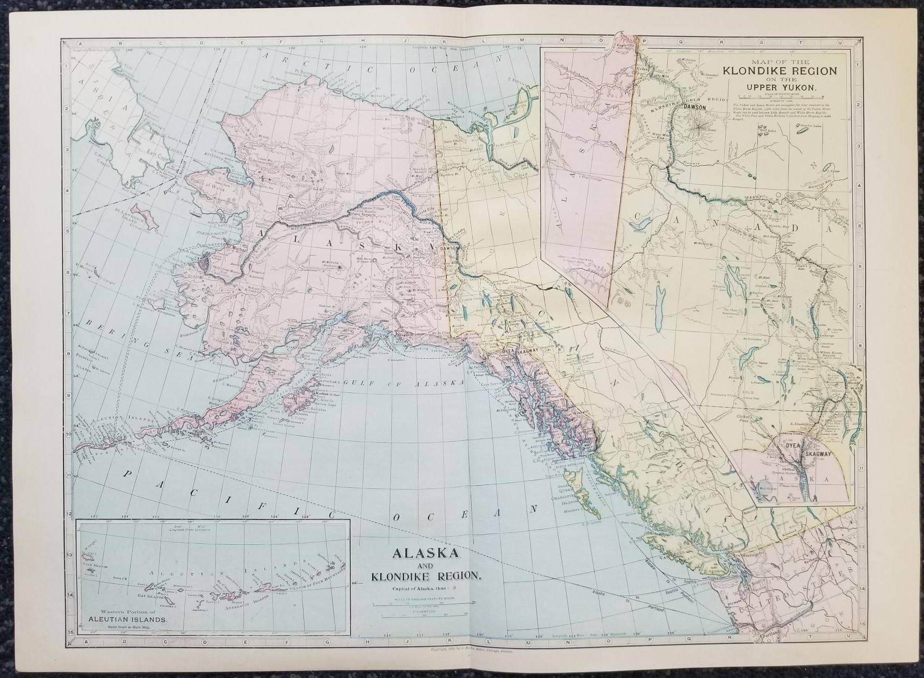
1899 — Map of Alaska and Klondike Region / Map of the Klondike Region on the Upper Yukon — in Color — Measures 16″ x 22″
$15.00
This map is one large sheet, folded in half it was pages 94 and 95 of an old atlas; text appears on the back of the map (pages 93 and 96).
Very good condition with no major tears; just one in the middle top margin.
Map copyrighted in 1899 by J. Martin Miller, Chicago, Illinois.
1 in stock
Description
U.S. map maps geography geographical mapping north american continent western hemisphere alaska state of canada mappings
Related products
-
1939 ~ Geographical Review ~ October ~ The American Geographical Society of New York
$12.50 Add to cart -

1992 ~ Haim Beinhart ~ Atlas of Medieval Jewish History
$24.00 Add to cart -

1993 ~ G. S. P. Freeman-Grenville ~ The Basilica of the Nativity in Bethlehem
$14.60 Add to cart -

1847 reprint ~ Franciscan Fathers ~ Guide to Jordan
$89.00 Add to cart -

8 Inches Tall — World Globe — Antique Globe — Bronze Colored Base — New in Box!
$29.00 Add to cart -
Papers of the New World Archaeological Foundation Number Fifty-Eight by Pierre Agrinier
$75.00 Add to cart -

1962 ~ Martin A. Beek ~ Atlas of Mesopotamia
$12.00 Add to cart -
Geography of the Book of Mormon (Signed!) (1959) ~ by Fletcher B. Hammond
$100.00 Add to cart -
Papers of the New World Archaeological Foundation Number Forty-Three by Joseph W. Ball
$18.00 Add to cart -
1992 ~ W. Glyn Jones and Kirsten Gade ~ Blue Guide Denmark
$14.30 Add to cart