Skip to navigation
Skip to content
Search for:
Search
Menu
Eborn Books Home
About Eborn Books — We Accept Credit Cards Thru WooPay
For Authors
Locations
Search Inventory
My account
Wish List
Cart
Checkout
New LDS Books!
Home
About Eborn Books — We Accept Credit Cards Thru WooPay
For Authors
Books, Pamphlets, Coins, Posters, Antiques, Knick-Knacks, Misc. Collectibles.
Cart
Checkout
Locations
My account
Wish List
New LDS Books!
Search Results
Terms and Conditions
$
0.00
0 items
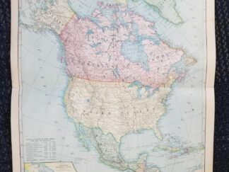
1899 — Map of North America — in Color — Measures 16″ x 22″
$
15.00
This map is one large sheet, folded in half it was pages 38 and 27 of an old atlas; text appears on the back of the map (pages 37 and 39).
Very good condition with no major tears; just one in the middle top margin.
Map copyrighted in 1899 by J. Martin Miller, Chicago, Illinois.
1 in stock
1899 --- Map of North America --- in Color --- Measures 16" x 22" quantity
Add to cart
SKU:
v1 loc0 mapnortham
Categories:
Geography
,
Maps
Description
Description
north america american western hemisphere map maps geography geographical mapping
Related products
1979 ~ Elisabeth S. Hakkinen ~ Haines -The First Century
$
15.00
Add to cart
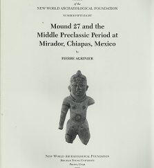
Papers of the New World Archaeological Foundation Number Fifty-Eight by Pierre Agrinier
$
75.00
Add to cart
Return to Cumorah: Piecing Together the Puzzle Where the Nephites Lived (1998) ~ by Duane R. Aston, PH.D.
$
10.00
Add to cart
1899 --- Map of the World --- in Color --- Measures 16" x 22"
1899 --- Map of the United States & Adjacent Countries: Mexico, Cuba, Canada, Etc. --- in Color --- Measures 16" x 22"
Search our Store at EbornBooks.com
Products search
Search
Search our Products
Products search
Search
Search our inventory on Amazon and Ebay!
Click here to view our product listings on Ebay!
Other Resources
You're viewing:
1899 — Map of North America — in Color — Measures 16″ x 22″
$
15.00
Add to cart