
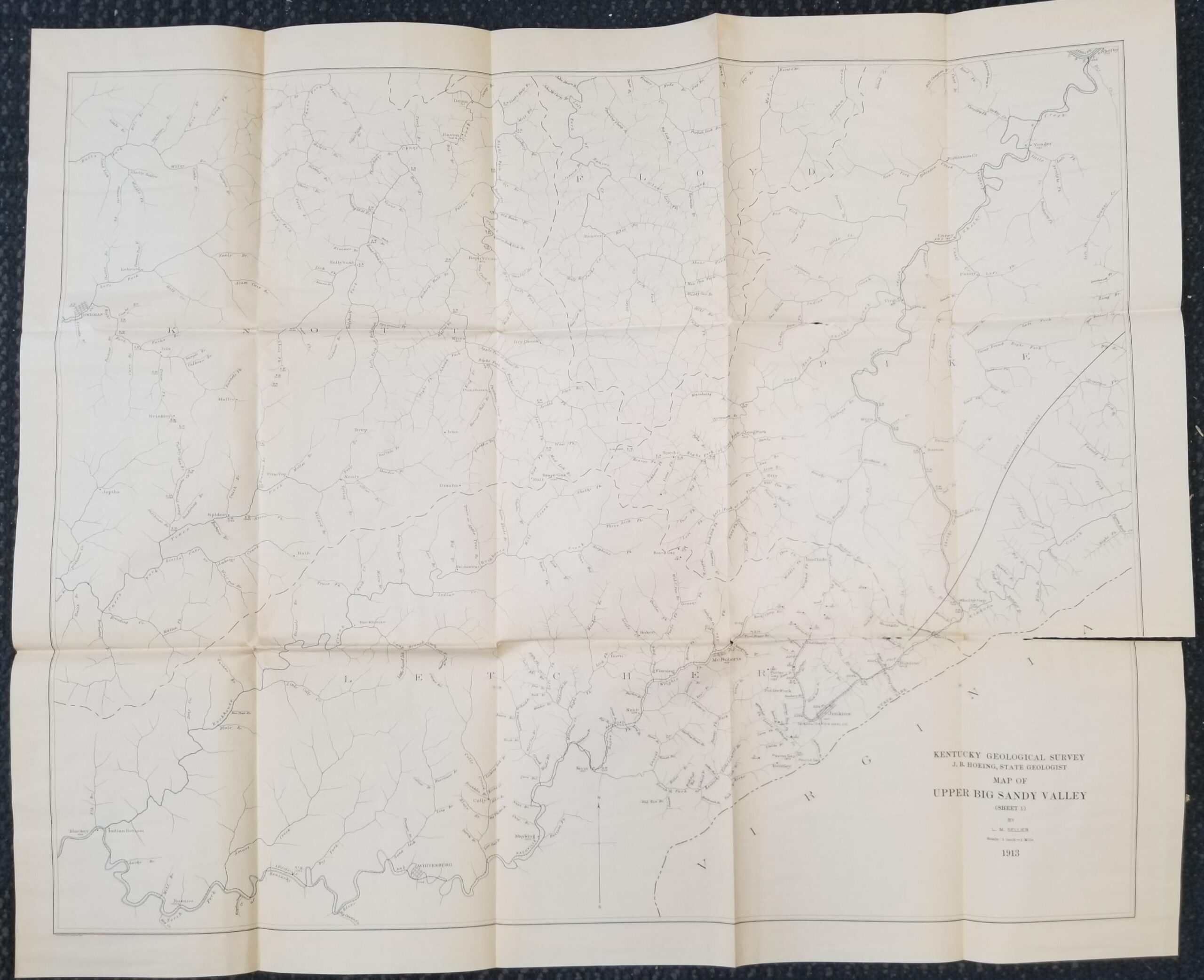
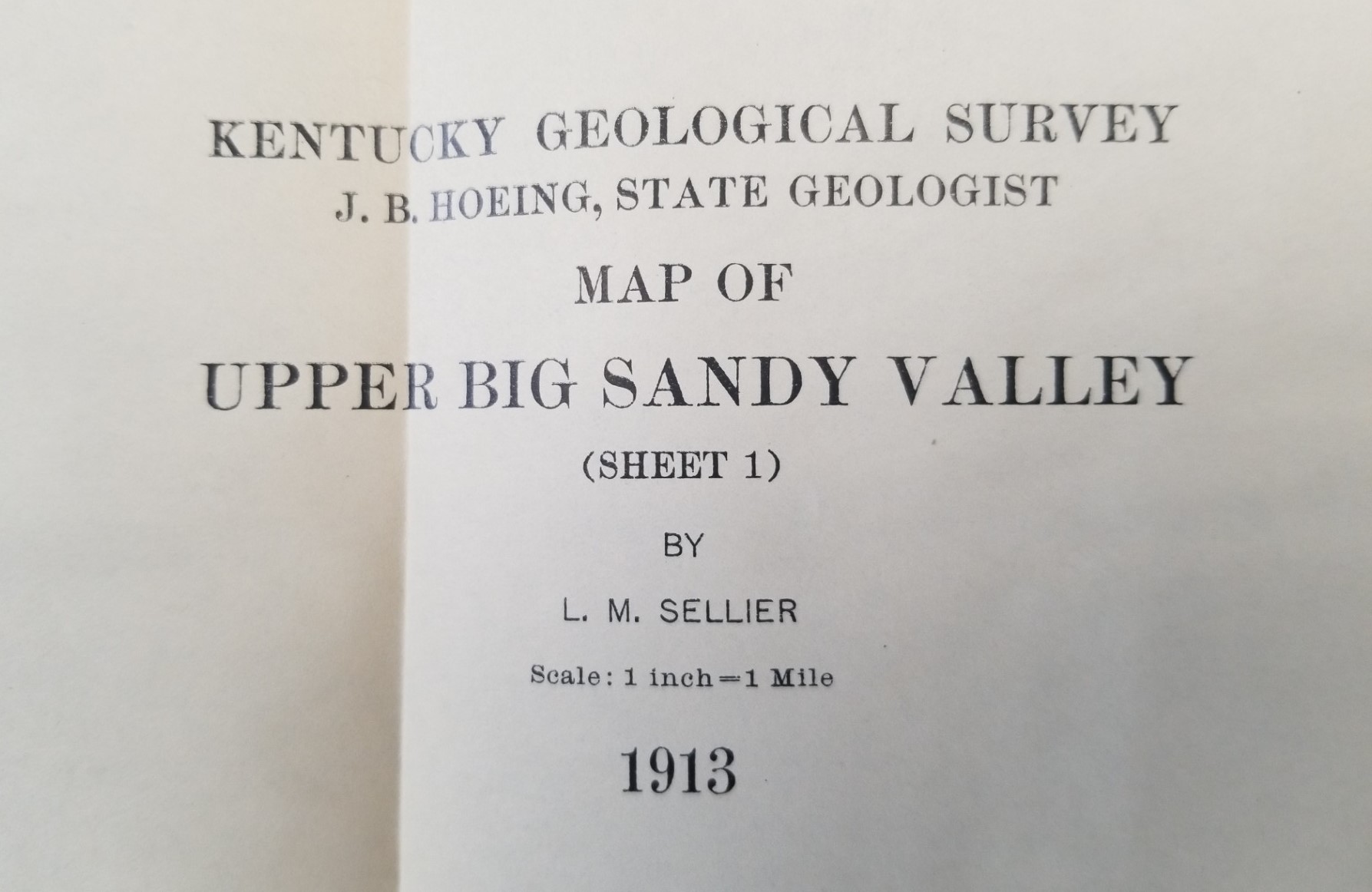
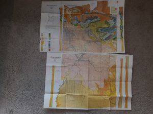
1913 — Map of Upper Big Sandy Valley (Sheet 1) — By L. M. Sellier — Kentucky Geological Survey, J. B. Hoeing, State Geologist — 30″ x 25″
$20.00
-
30 Inches Wide
-
25 Inches Tall
-
Date on Map is 1913
-
Many creases from folding
-
A few of those creases have torn
-
Overall pretty good
-
Click on photos below to enlarge:
1 in stock
Description
map maps kentucky geology
Related products
-
Geologic Map of the Dugway Proving Ground SW Quadrangle, Utah (Map GQ-992)
$9.99 Add to cart -
The Romance of Boston Bay w/ Map (1944) ~ by Edward Rowe Snow
$15.00 Add to cart -
2 Geologic Maps of Uintah County, Utah (North Half, South Half) ~ by G. E. and B. R. Untermann, and D. M. Kinney
$15.00 Add to cart -

Geologic Map of the Cedar City Quadrangle, Iron County, Utah (Map GQ-1120)
$10.00 Add to cart -
Map of Norfolk, Virginia and Miscellaneous Information for Visitors and New Residents (Map)
$12.50 Add to cart -
Geologic Map of the Crouse Reservoir Quadrangle, Utah (Map GQ-1554)
$10.00 Add to cart -
Washington West Quadrangle District of Columbia—Maryland—Virgina 7.5 Minute Series (Topographic) Map (1971, Revised)
$15.00 Add to cart -
Geologic Map of the Bridal Veil Falls Quadrangle, Utah (Map GQ-998)
$10.00 Add to cart -
Geologic Map of California San Francisco Sheet (1961)
$12.50 Add to cart -
Geologic Map of the Southwest Quarter of the Gunsight Butte Quadrangle: Map MF-206 – Fred Petersen
$25.00 Add to cart