
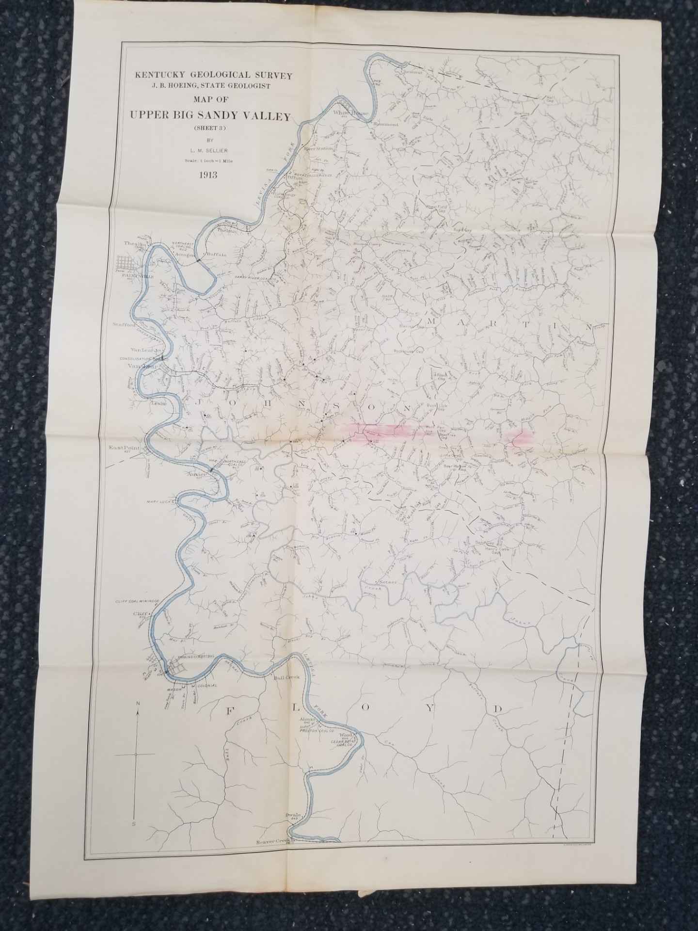
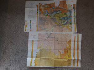
1913 — Map of Upper Big Sandy Valley (Sheet 3) — By L. M. Sellier — Measures about 22 inches Tall
$15.00
This map has fold marks and has some kind of staining and pink smudging in the middle. Overall pretty good.
Sheet 3.
1 in stock
Description
map maps geology kentucky
Related products
-
Geologic Map of the Northeast Quarter of the Morgan 15-Minute Quadrangle: Map MF-304 – Thomas E. Mullens & Thomas H. Cole
$20.00 Add to cart -
Geology of the Southern Wasatch Mountains and Vicinity, Utah Map (1962)~ by Lehi F. Hintze
$12.50 Add to cart -

Geologic Map of the Mills Junction Quadrangle, Tooele County, Utah (Map GQ-924)
$10.00 Add to cart -
Geologic Map of the Morgan 7 1/2-Minute Quadrangle, Utah: MF-318 – Thomas E. Mullens & William H. Laraway
$25.00 Add to cart -
Geologic Map of the Dugway Proving Ground SW Quadrangle, Utah (Map GQ-992)
$9.99 Add to cart -
The Romance of Boston Bay w/ Map (1944) ~ by Edward Rowe Snow
$15.00 Add to cart -
Map Showing Locations of Mines & Prospects in the Dillon Quadrangle (I-1803-C) Idaho & Montana
$10.00 Add to cart -
2 Geologic Maps of Uintah County, Utah (North Half, South Half) ~ by G. E. and B. R. Untermann, and D. M. Kinney
$15.00 Add to cart -

Geologic Map of the Thermo 15-Minute Quadrangle, Utah (Map GQ-1493)
$10.00 Add to cart -

Geologic Map of the Stuntz Reservoir Quadrangle, Utah-Colorado (Map GQ-1530)
$10.00 Add to cart