
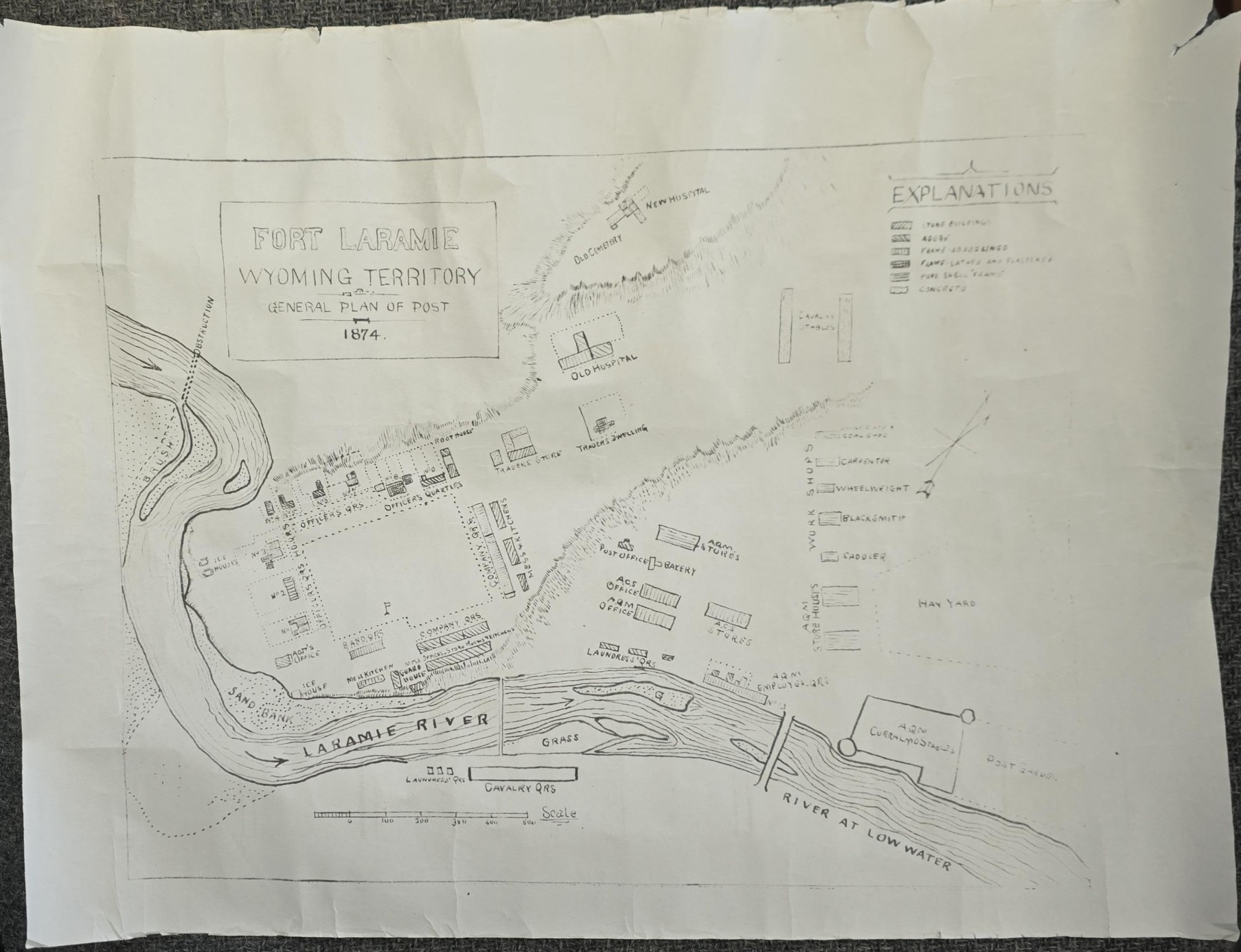
Map of Fort Laramie, Wyoming Territory, General Plan of Post — 15″ x 11.5″ — Reprint of the 1874
$15.00
This map says 1875 but it was most certainly printed much later. It measures 15 inches wide and 11 and a half inches tall. Edges are a bit rough. Fair condition, as pictured.
1 in stock
Related products
-
The Trail Blazer – History of the Development of Southeastern Idaho
$24.00 Add to cart -

Prince of Gunfighters – Charles S. Strong – 1958 – Rare Western!
$100.00 Add to cart -

A History of the Gilsonite Industry – Newell G. Remington
$150.00 Add to cart -

Chesterfield: Mormon Outpost in Idaho Edited by Lavina Fielding Anderson (1982)
$19.99 Add to cart -
The Anglo-Saxon Settlement of the Far West Prior to 1850. A Thesis … Roscoe Eldon Hammond
$75.00 Add to cart -

History of California. 4 Volume Set. (Bancroft’s Works Volumes 18-21). (Hardcover)
$27.50 Add to cart -

A Mirror for Americans: Life and Manners in the United States 1790-1870 as Recorded by American Travelers, Vol. III by Warren S. Tryon
$17.00 Add to cart -
Sagebrush Literature (Signed), by John W. Saunders
$15.00 Add to cart -

The Mesa Verde Story ~ Envelope with 5 Cards
$15.00 Add to cart -

1855 Prison of Weltevreden, and a Glance at the East Indian Archipelago – Walter M. Gibson
$88.00 Add to cart