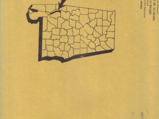
Description
20 Maps in Total. All black and white.
Geological Survey of Alabama, State Oil and Gas Board.
- Map 8: Profile Showing Geology Along State Highway 17, Choctaw County, Alabama
- Map 9: Profile Showing Geology Along State Highway 100, Wilcox County, Alabama
- Map 10: Profile Showing Geology Along U.S. Highway 331, Montgomery County, Alabama
- Map 11: Profile Showing Geology Along State Highway 25, Marengo County, Alabama
- Map 12: Geologic Map of Wilcox County, Alabama
- Map 13: Geologic Map of Limestone County, Alabama
- Map 15: Generalized Geologic Map of Etowah County, Alabama
- Map 16: Geologic Map of Tuscaloosa County, Alabama
- Map 17: Geologic Map of Calhoun County, Alabama
- Map 18: Geologic Map of Lauderdale County, Alabama
- Map 19: Geologic Map of Bullock County, Alabama
- Map 20: Geologic Map of Colbert County, Alabama
- Map 21: Generalized Geologic Map of St. Clair County, Alabama
- Map 22: Geologic Map of Franklin County, Alabama
- Map 24: Geologic Map of Russell County, Alabama
- Map 25: Geologic Map of Madison County, Alabama
- Map 26: Geologic Map of Escambia County, Alabama
- Map 27: Profile Showing Geology Along State Highway 69 and County Highway 15, Clarke County, Alabama.
- Map 28: Profile Showing Geology Along the Chattahoochee River
- Map 29: Water-Level Fluctuations and Chemical Quality of Ground Water in Alabama