
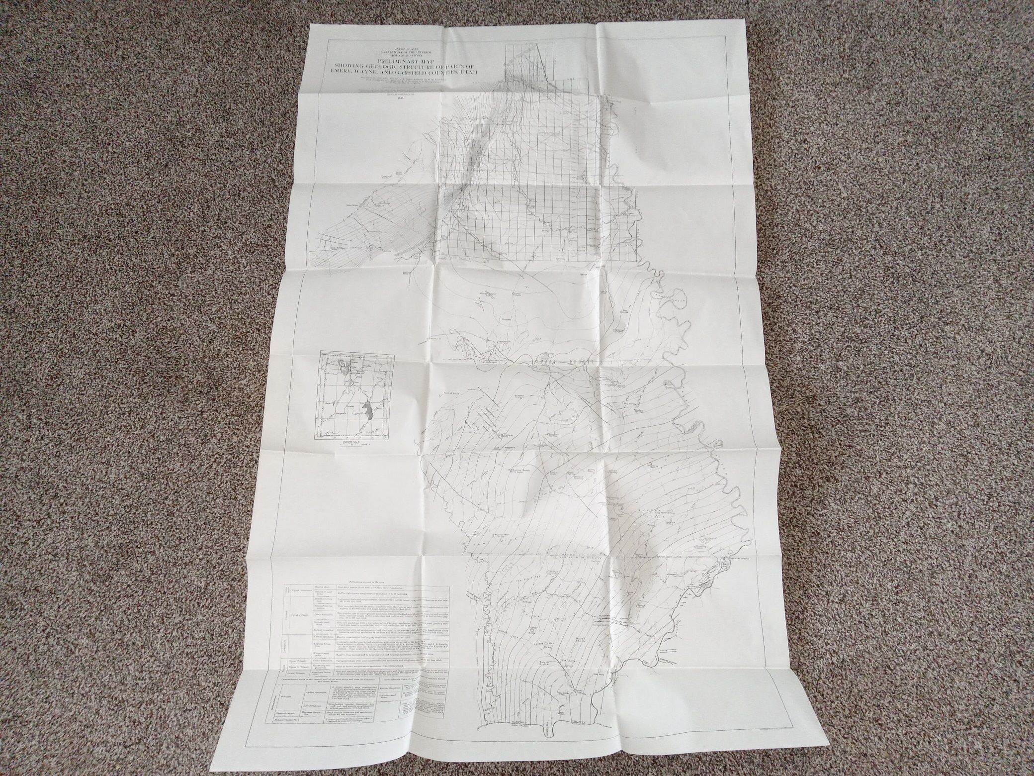
Preliminary Map Showing Geologic Structure of Parts of Emery, Wayne, and Garfield Counties, Utah (1933) ~ Surveyed by A. A. Baker, Assisted, by M. M. Knechtel, D. A. Andrews, A. J. Eardley, L. G. Henbest, L. S. Bumgardner, H. D. Curry and R. L. Miller
$17.50
Preliminary Map Showing Geologic Structure of Parts of Emery, Wayne, and Garfield Counties, Utah
Surveyed by A. A. Baker, Assisted, by M. M. Knechtel, D. A. Andrews, A. J. Eardley, L. G. Henbest, L. S. Bumgardner, H. D. Curry and R. L. Miller
Published: 1933
Fair condition, large, fold-up map. The map has some small stains, and some writing in pencil. Text and illustrations throughout are clear and legible.
v111 1906S
1 in stock
Description
Preliminary Map Showing Geologic Structure of Parts of Emery, Wayne, and Garfield Counties, Utah
Surveyed by A. A. Baker, Assisted, by M. M. Knechtel, D. A. Andrews, A. J. Eardley, L. G. Henbest, L. S. Bumgardner, H. D. Curry and R. L. Miller
Published: 1933
Fair condition, large, fold-up map. The map has some small stains, and some writing in pencil. Text and illustrations throughout are clear and legible.
v111 1906S
Related products
-

Jottings by Margaret Ann Hill Francis (Compiled by Allen Archibald Francis)
$150.00 Add to cart -
An Historical Study of Bluff City, Utah from 1878 to 1906 by Bryant L. Jensen
$75.00 Add to cart -

History of Ole Van Harris and Wife, Annie May Perry Harris by. Daughter Mildred Harris Olsen
$50.00 Add to cart -
Christian Sorensen Family History – They Followed Their Faith
$200.00 Add to cart -
A Demographic Examination of Household Heads in Salt Lake City, Utah, 1850-1870 by Larry Wayne Draper 1988
$50.00 Add to cart -
A Examination of the Mormon Settlement of Syracuse, Utah ~ by J. Kent Tucker ~ 1987
$50.00 Add to cart -

Writings of Joseph A. Cornwall (Compiled in 1962)
$100.00 Add to cart -
Malan Book of Remembrance – Descendants of John Daniel Malan Volume II (Compiled by J. Malan Heslop)
$200.00 Add to cart -

Blue Mountain Shadows (A Magazine of San Juan County History) Vol. 9/Winter 1991
$15.00 Add to cart -

The World of Michael Phillips and His Descendants – Volume 1
$100.00 Add to cart