


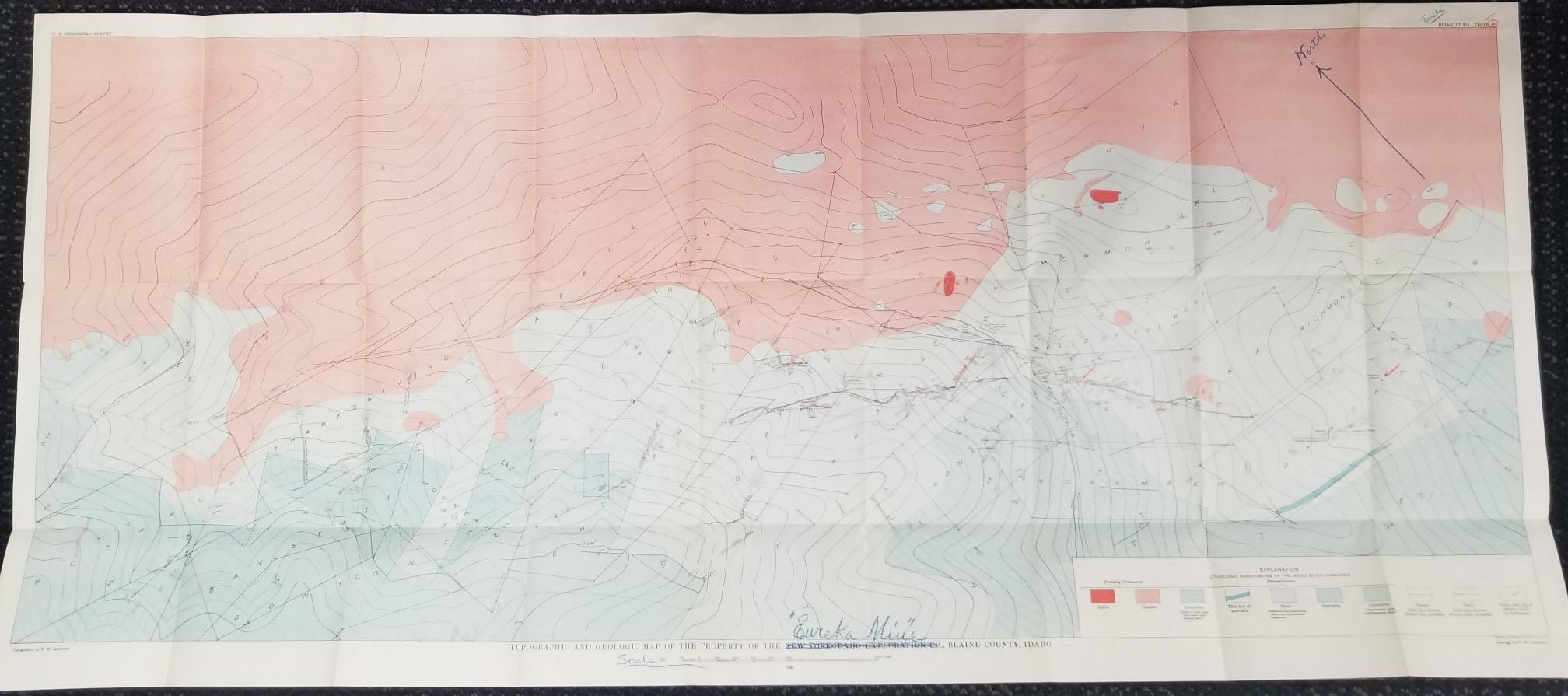
1930 — Topographic and Geologic Map of the Property of the New York-Idaho Exploration Co., Blaine County Idaho — “Eureka Mine” — 44.5″ x 19.5″
$125.00
Someone marked out “New York-Idaho Exploration Co” and wrote in “Eureka Mine.”
This map is 44 inches wide and almost 20 inches tall. Folded with creases, but in fantastic condition!
U.S. Geological Survey; Bulletin 814. Plate 20.
Geology by R. W. Landwehr
Topography by R. W. Landwehr
1 in stock
Description
map maps geology idaho mining mine mines
Related products
-

Formulas and Tables to Facilitate the Construction and Use of Maps (No. 50)
$50.00 Add to cart -

Transactions of the American Institute of Mining and Metallurgical Engineers Vol. LXVI 1922
$50.00 Add to cart -

Availability of Groundwater in Parts of the Acoma and laguna Indian Reservations, New Mexico (Geological Survey Water-Supply Paper 1576E)
$20.00 Add to cart -

Placer Deposits of Alaska by Edward H. Cobb (Bulletin 1374)
$35.00 Add to cart -

Transactions of the American Institute of Mining and Metallurgical Engineers Vol. LXXII 1925
$50.00 Add to cart -

Studies in Archaeology Highway 1A Coal Creek Alberta by Michael McIntyre
$25.00 Add to cart -

Geochemistry and Diagenesis of Tidal-Marsh Sediment, Northeaster Gulf of Mexico by Vernon E. Swanson, Alonza H. Love, and Irving C. Frost (Bulletin 1360)
$35.00 Add to cart -

Geology, Ore Deposits, and Exploratory Drilling in the Deer Flat Area White Canyon District San Juan County, Utah by Tommy L. Finnell, Paul C. Franks, and Harold A. Hubbard (Bulletin 1132)
$35.00 Add to cart -

Oxidized Zinc Deposits of the United States Part 2. Utah by Allen V. Heyl (Bulletin 1135-B)
$35.00 Add to cart -

Transactions of the American Institute of Mining Engineers Vol. LVI
$50.00 Add to cart
Reviews
There are no reviews yet.