
Showing 41–60 of 260 resultsSorted by latest
-
Geologic Map and Sections of the Silver Reef District, Utah (1918) ~ Unknown Cartographer
$8.00 Add to cart -
Map of Moab’s Slickrock Bike Trail and Sand Flats Recreation Area (Double-Sided, Fold-Up Map) (1994) ~ by Rick Showalter
$15.00 Add to cart -
Preliminary Geologic Map of the Circle Cliffs 1 SE Quadrangle, Garfield County, Utah (Fold-Up Map) (1958) ~ by Edward S. Davidson, David A. Brew, Louis D. Carswell
$15.00 Add to cart -
Utah Historical Trails Map (Fold-Out Map) (1948) ~ Prepared by Dale L. Morgan
$195.00 Add to cart -

1930 — Topographic and Geologic Map of the Mascot Group, Blaine County, Idaho — Bulletin 814. Plate 25 / 19″ x 37″
$125.00 Add to cart -

1930 — Topographic and Geologic Map of the Property of the New York-Idaho Exploration Co., Blaine County Idaho — “Eureka Mine” — 44.5″ x 19.5″
$125.00 Add to cart -
Kentucky Geological Survey: Map of Georgetown Quadrangle: 1913 (Fold-up Map) (1913)
$20.00 Add to cart -
Kentucky Geological Survey: Sketch Map of A Portion of Rowan County (Fold-Up Map) (1913) ~ by L. M. Sellier
$15.00 Add to cart -

Geologic Map of Salt Lake County, Utah — LARGE SIZE — Ray E. Marsell and Richard L. Threat — 4 Feet Wide & 38 Inches Tall — June 1960
$45.00 Add to cart -

1913 — Map of Upper Big Sandy Valley (Sheet 4) — By L. M. Sellier — Measures about 27 inches Wide and 28 inches Tall
$20.00 Add to cart -

1913 — Map of Upper Big Sandy Valley (Sheet 2) — By L. M. Sellier — Measures about 26 inches Wide and 18 inches Tall
$15.00 Add to cart -

1913 — Map of Upper Big Sandy Valley (Sheet 3) — By L. M. Sellier — Measures about 22 inches Tall
$15.00 Add to cart -
1913 — Map of Upper Big Sandy Valley (Sheet 1) — By L. M. Sellier — Kentucky Geological Survey, J. B. Hoeing, State Geologist — 30″ x 25″
$20.00 Add to cart -

1913 — Map of Pond & Blackberry Creeks — By L. M. Sellier — Kentucky Geological Survey — About 13″ x 14″
$15.00 Add to cart -
1918 — Map of the Western Theatre of War — Gilbert Grosvenor, editor — 33″ x 27″
$39.50 Add to cart -

Kentucky Geological Survey, J.B. Hoeing, State Geologist: Map of Boyd, Carter & Greenup Counties (1913) ~ by L. M. Sellier
$15.00 Add to cart -

Map of Japan, Corea and Manchuria (1904)
$11.00 Add to cart -
Classroom Helper World Map: 35 Sheets per Pad (New) (1992)
$9.99 Add to cart -
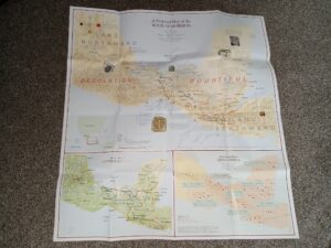
A Proposed Map of the Book of Mormon (Unknown Publishing Date) ~ Researched and Compiled by Joseph L. Allen, Ph. D., President of Book of Mormon Tours, Edited Jeffrey Larson and Jace Willard, Cartographer Bruce Cheney
$15.00 Add to cart -

1889 — Costello & Holt’s Map of the City and County of San Francisco, California — Huge Map Measures 4 feet tall and 5 feet wide!
$5,900.00 Add to cart