
Showing 61–80 of 260 resultsSorted by latest
-

Tobin: San Antonio, Texas (Oil Industry Maps) (1966)
$40.00 Add to cart -
![1899 — Reference Map of Palestine— in Color — Measures 16″ x 22″ — [Judea, Edom or Idumea, Ammon, Gilead, Decapolis, Galilee, Samaria, Philistia, Dead Sea, Sea of Galilee]](https://ebornbooks.com/wp-content/uploads/2024/02/Pot13-13-300x225.jpg)
1899 — Reference Map of Palestine— in Color — Measures 16″ x 22″ — [Judea, Edom or Idumea, Ammon, Gilead, Decapolis, Galilee, Samaria, Philistia, Dead Sea, Sea of Galilee]
$19.50 Add to cart -
![1899 — Map of Europe— in Color — Measures 16″ x 22″ — [British Isles, Great Britain, Spain, France, German Empire, Russia, Austria-Hungary, Italy, Turkey, Portugal, Sweden, Denmark, Netherlands, Belgium, Norway, Iceland]](https://ebornbooks.com/wp-content/uploads/2024/02/Pot13-12-300x225.jpg)
1899 — Map of Europe— in Color — Measures 16″ x 22″ — [British Isles, Great Britain, Spain, France, German Empire, Russia, Austria-Hungary, Italy, Turkey, Portugal, Sweden, Denmark, Netherlands, Belgium, Norway, Iceland]
$15.00 Add to cart -
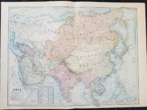
1899 — Map of Asia — in Color — Measures 16″ x 22″ — [Russian Empire, Chinese Empire, Mongolia, India, Empire of Japan, Turkish Empire, Persia, Arabia, Siam
$15.00 Add to cart -
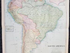
1899 — Map of South America — in Color — Measures 16″ x 22″
$15.00 Add to cart -
![1899 — Map of British America [ Canada ] — in Color — Measures 16″ x 22″](https://ebornbooks.com/wp-content/uploads/2024/02/Pot13-9-300x225.jpg)
1899 — Map of British America [ Canada ] — in Color — Measures 16″ x 22″
$15.00 Add to cart -
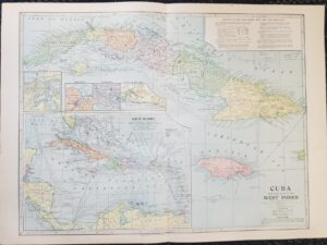
1899 — Map of Cuba with General Map of the West Indies — in Color — Measures 16″ x 22″
$15.00 Add to cart -

1899 — Map of Alaska and Klondike Region / Map of the Klondike Region on the Upper Yukon — in Color — Measures 16″ x 22″
$15.00 Add to cart -
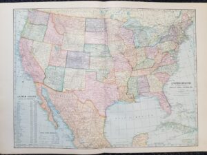
1899 — Map of the United States & Adjacent Countries: Mexico, Cuba, Canada, Etc. — in Color — Measures 16″ x 22″
$15.00 Add to cart -

1899 — Map of North America — in Color — Measures 16″ x 22″
$15.00 Add to cart -

1899 — Map of the World — in Color — Measures 16″ x 22″
$15.00 Add to cart -
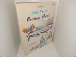
Dowlers Lake Powell Boating Guide: Detailed Maps (1976)
$19.50 Add to cart -

The Mapmaker’s Art (1953, Hardcover)
$19.70 Add to cart -
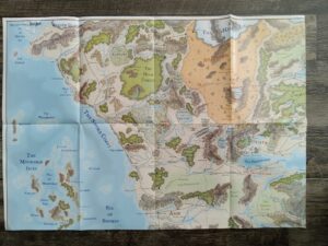
Untitled Map From Your Friends @ Dragon (Unknown Publishing Date)
$15.00 Add to cart -
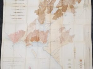
1907 — Large “Geological Map and Sections of Controller Bay Region, Alaska — 3′ Wide x 3′ Tall
$20.00 Add to cart -
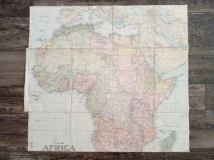
Fold-up Map of Africa and Adjoining Portions of Europe and Asia (1922)
$15.00 Add to cart -

A Fold-up Map from Your Friends at Dragon (No Publishing Date)
$15.00 Add to cart -
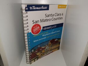
Santa Clara & San Mateo Counties Street Guide (38th Edition) (2009)
$25.00 Add to cart -
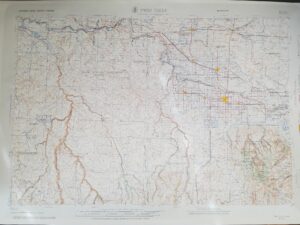
Twin Falls, Idaho — Large Contour Plastic Map — 21″ x 31″
$49.95 Add to cart -
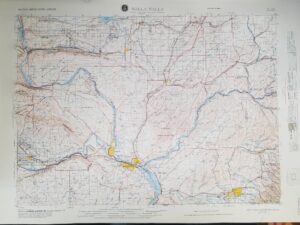
Walla Walla, Washington (Oregon) NL 11-4 Revised 1981 — Contour Map — Plastic — Large Size
$49.95 Add to cart